Scientist of the Day - Konrad Celtes


Konrad Celtes, a German Renaissance humanist, was born Feb. 1, 1459. Sometime before 1508, Celtes discovered a map, a really old map, in a monastery library in Germany. He died very soon thereafter, bequeathing the map to his fellow humanist, Konrad Peutinger, and although Peutinger didn't do anything with the map, except pass it on again, it has been known ever since as the Peutinger map, and poor Celtes's role has been forgotten.
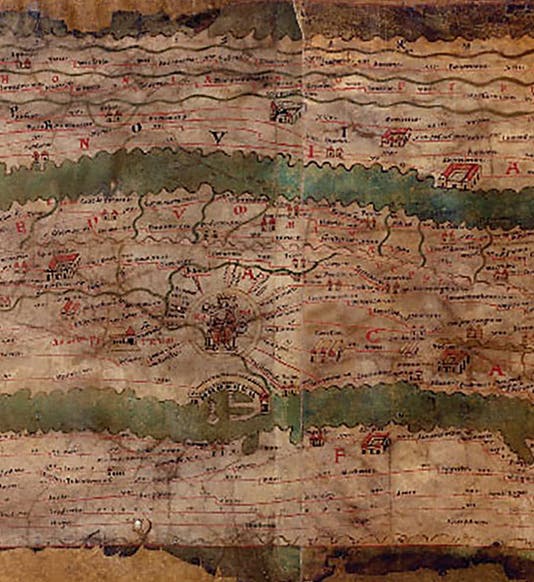
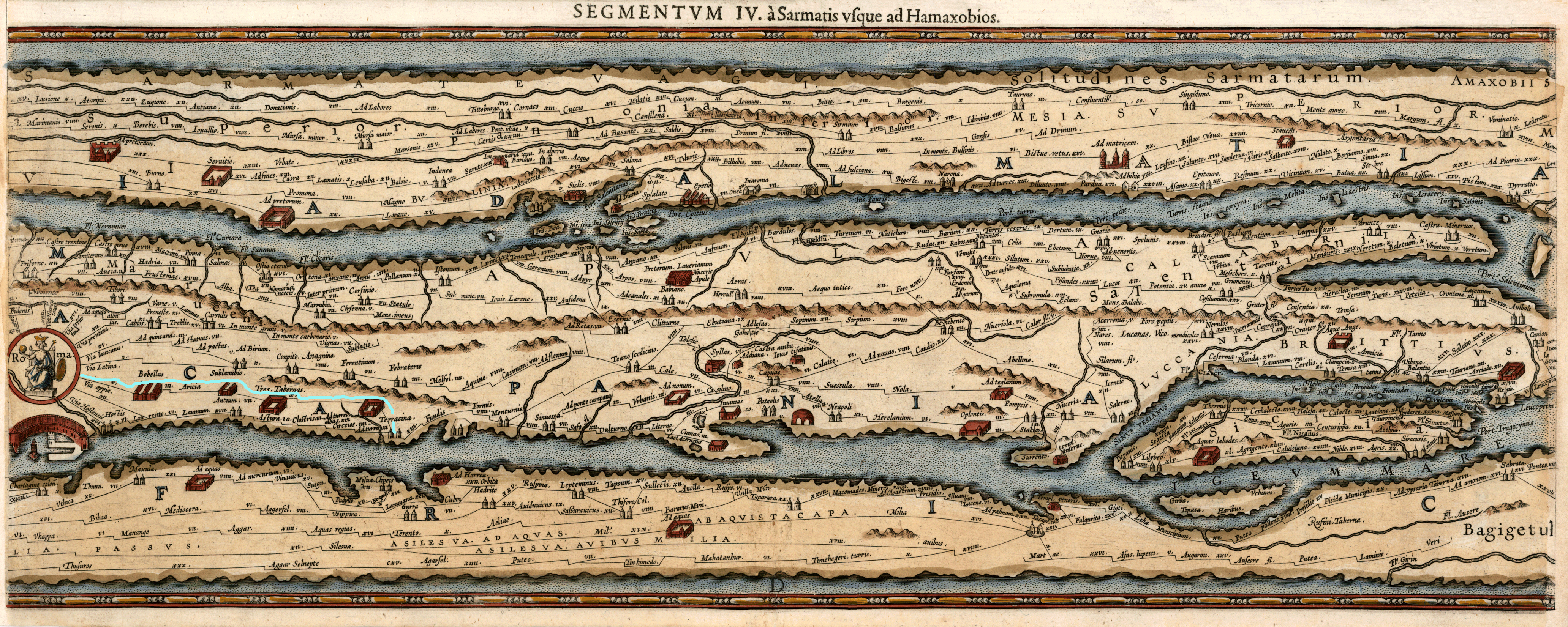
The Peutinger map (detail, first image) is the only surviving road map from Roman times. Although the existing map was made around 1200, it appears to be a copy of a map made around 360 AD. The map is a parchment scroll (although it is now kept in separate sheets), only about 13 inches tall but over 22 feet long. There is a useful image on Wikipedia that allows you to “scroll the scroll” left and right (scroll down one screen to the section headed "Map"; the scroll bar is just below the map). You can see that although this is a large-area map, it is unlike any map we are used to. The vertical scale is practically non-existent, so that Africa is just below Italy which lies just below mainland Europe. But the horizontal scale is wonderful, depicting over 70,000 miles of Roman roads connecting cities (like Rome and Antioch), towns, garrisons, depots, staging points, and crossroads, all the way from Britain to India. The map was first printed in 1598 (detail, second image), but the best early edition is that of 1753, an over-size folio that divides the map into 12 plates; it is titled Peutingeriana tabula itineraria, and we have this work in the Library, and it is the basis for most later printed editions (detail, third image). The plates are large enough that one can read all of the thousands of place names quite easily, which is hard to do on the various online versions (or on the original, for that matter).
The original map was acquired in the 1730s by the Vienna National Library, which prompted the 1753 publication, and that is where the map may still be found today, although its condition is quite precarious and it is seldom put on display. The map is often referred to as the “Peutinger Table,” a translation of “Peutingeriana tabula,” but that is just silly, as it is not a table at all. And it should be called the Celtesian map, anyway.
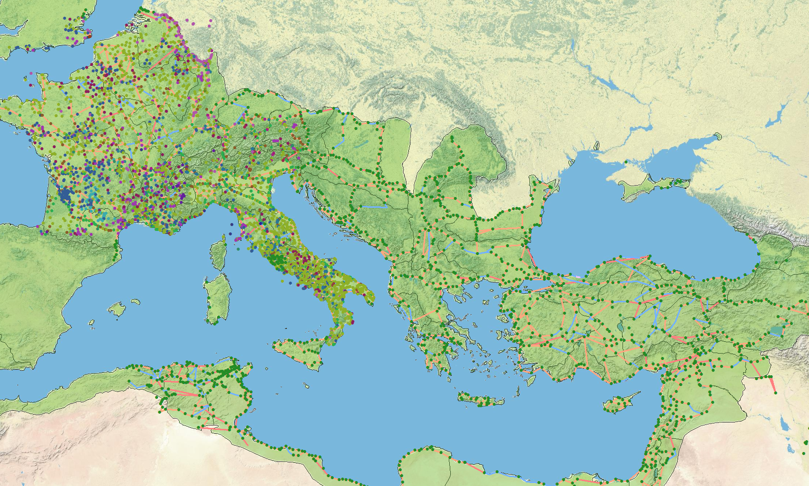
Stanford University Libraries has compiled a “digital Peutinger map,” transforming the details to a modern projection that is more familiar (fourth image). Celtes himself has been commemorated on a German postage stamp (fifth image).
Dr. William B. Ashworth, Jr., Consultant for the History of Science, Linda Hall Library and Associate Professor, Department of History, University of Missouri-Kansas City. Comments or corrections are welcome; please direct to ashworthw@umkc.edu.