Scientist of the Day - Pierre Bouguer

Linda Hall Library
Linda Hall Library
Linda Hall Library
Linda Hall Library
Linda Hall Library

Wikipedia
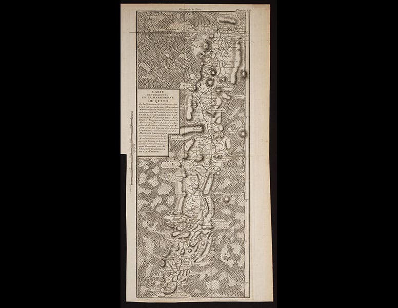
Pierre Bouguer, a French mathematican , astronomer, and geodesist, was born Feb. 16, 1698. In 1735, Bourguer was sent to Ecuador, along with Charles-Marie de La Condamine and Louis Godin, to measure the length of a degree at the equator. It was hoped by the Royal Academy of Sciences in Paris that by comparing the Ecuadorian measurement with the length of a degree in Lapland, that one might be able to determine if the earth is perfectly spherical, or oblate (shaped like an onion), or prolate (shaped like a lemon). The expedition to Ecuador lasted nine years, during which time the French team triangulated their way from Quito south through the Andes for over 200 miles, wending through volcanoes such as Cotopaxi and Chimborazo. When they returned home, each of the men wrote a book-length account of their adventures, as did as pair of Spanish scientific officers who were there as observers. We have the complete set of volumes in our History of Science Collection.
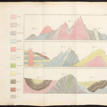
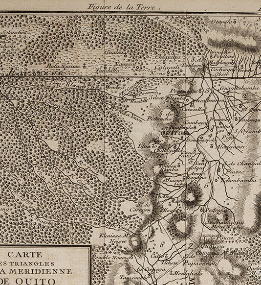
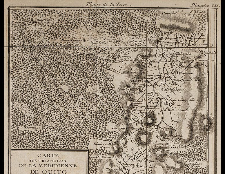
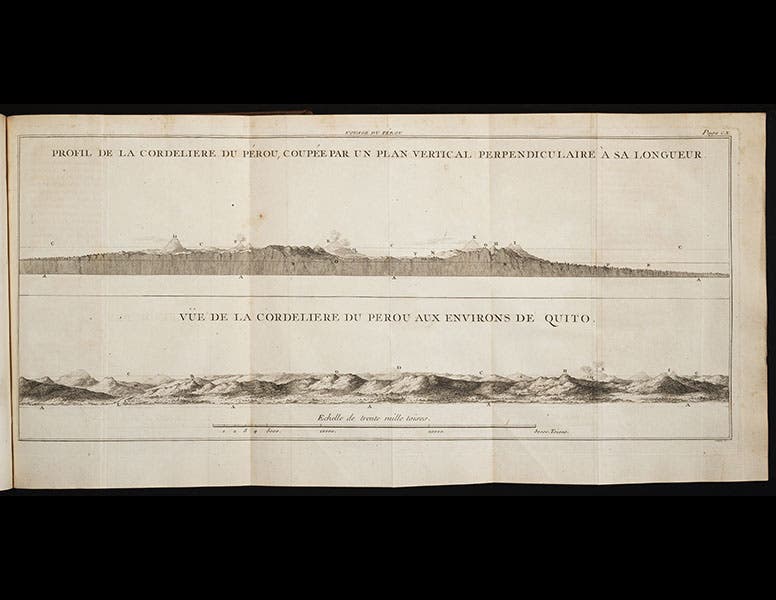
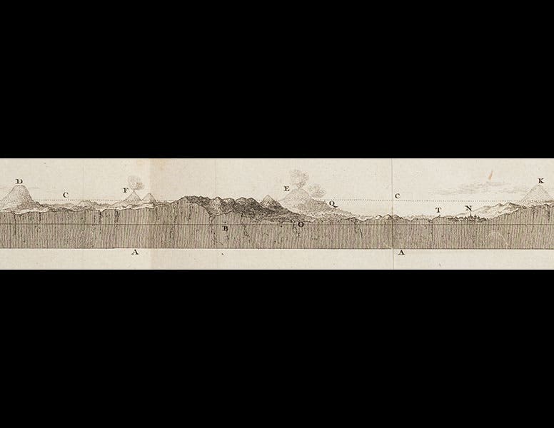
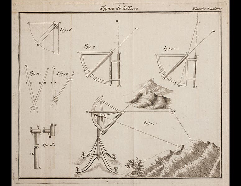
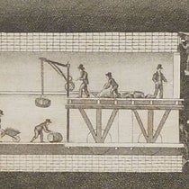
Bourguer’s book was called La Figure de la Terre and was published in 1749. It includes a plate that shows a view and a section of the Andes around Quito; we see above the entire map (second image), and also a detail of the section at top that includes the volcanoes Antisana (D), Cotopaxi (E), Tungurahua (F), and Chimborazo (K) (third image). Another plate shows a quadrant being used to triangulate between two of the signal stations (fourth image). The final folding plate shows a birds-eye view of the Andes south of Quito, including all of the signal stations and the triangles that they so carefully measured (fifth image). We also show a detail of the top third of the map (first image).
The results of the Ecuador and Lapland expeditions showed that the earth is slightly oblate, or squashed at the poles, just as Isaac Newton had predicted. There is a portrait of Bouguer in the Louvre (sixth image).
Dr. William B. Ashworth, Jr., Consultant for the History of Science, Linda Hall Library and Associate Professor, Department of History, University of Missouri-Kansas City. Comments or corrections are welcome; please direct to ashworthw@umkc.edu.

![“Aurora Borealis,” hand-colored wood engraving by Josiah Wood Whymper, [Natural Phenomena], plate 2, 1846 (Linda Hall Library)](https://assets-us-01.kc-usercontent.com:443/9dd25524-761a-000d-d79f-86a5086d4774/0245ffcb-b70c-477c-8792-0a73ebd54eb2/Whymper%2011.jpg?w=210&h=210&auto=format&fit=crop)