Scientist of the Day - Jean-Étienne Guettard

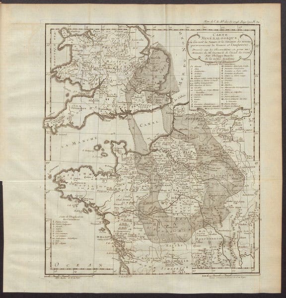
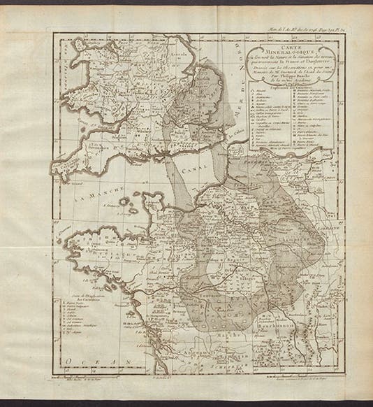
Second mineralogical map, covering France and England, by Jean-Étienne Guettard, in Memoires de l’académie royale des sciences pour 1746 (Linda Hall Library)
Jean-Étienne Guettard, a French geologist, mineralogist, and naturalist, was born Sep. 22, 1715. He was employed by the Duc d'Orleans as house naturalist and keeper of his cabinet, and when the duke died, he left Guettard a sum that allowed him to do pretty much what he wanted, which was traipse around France collecting plants and minerals, and observing the general lay of the land.
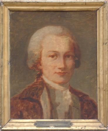
Portrait of Jean-Étienne Guettard, by Th. Charpentier, unknown date, unknown location (alchetron.com)
Guettard has several claims to geological fame, or at least respect. In 1746, he compiled and printed in the Memoires of the Paris Academy of Sciences the first geological map anywhere. In fact, he printed two of them, one showing all of Europe (fifth image), the second zeroing in on France and England (first image). He calls it a mineralogical map, which is more accurate geological map, since Guettard does not claim to show the rocks on the surface (like the subsequent geological maps of, say, William Smith), but simply shows where you are likely for find various metals, minerals, and types of stone. I am sure someone knows what the irregular circular band is that travels from France to England and back again, but it is hard to tell from the legend at upper right (third image). It is probably “pierre blanche,” or white limestone, such as is exposed at Dover in England.

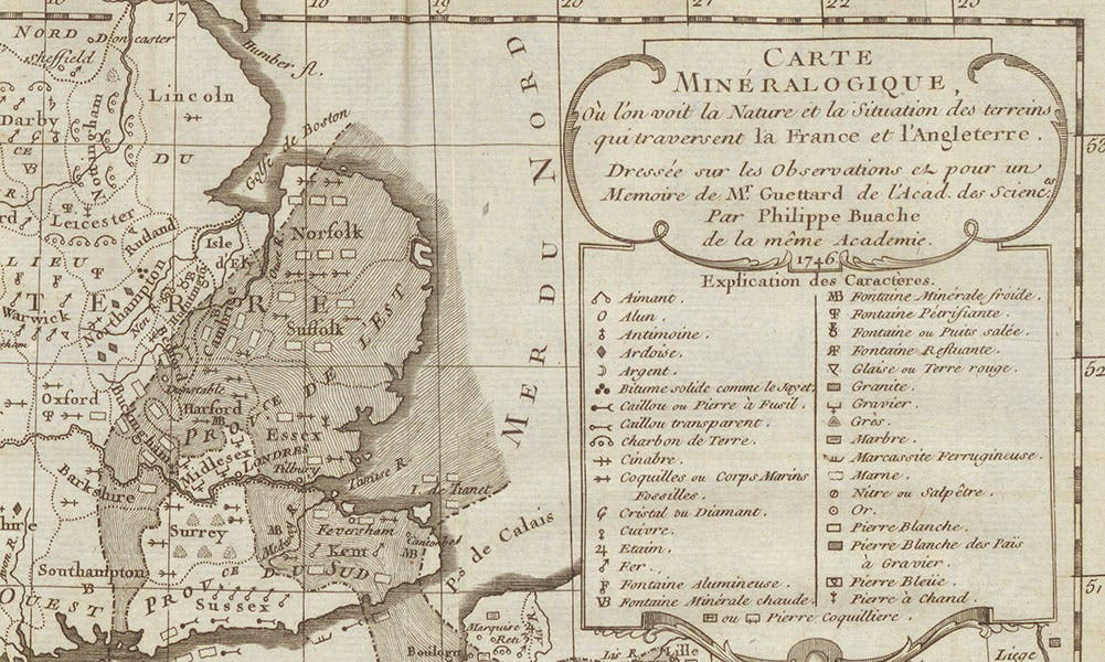
Detail of second mineralogical map, showing the legend at top right, Jean-Étienne Guettard, in Memoires de l’académie royale des sciences pour 1746 (Linda Hall Library)
In 1751, Guettard and a fellow traveler were visiting Clermont and the Auvergne region of France, part of what is called the Central Massif, where most of the mountains of France are located (see the detail of the bottom of his second mineralogical map, which shows Clermont and the Auvergne region, fourth image). Guettard wanted to see the Puy de Dôme, where Blaise Pascal's brother in law, Florin Perier, had carried a barometer, or Torricellian tube, up the mountain in 1648, which is why they were in the vicinity of Clermont (we wrote a post just three days ago on the Puy de Dôme experiment). Guettard observed quite a few mileposts, and some houses, built of a black stone that looked to him like volcanic rock. He was told it came from a village named Volvic, north of Clermont, and he sought it out, found the quarry, and traced the rock to cones in the mountains that looked just like old volcanoes.

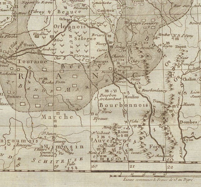
Detail of second mineralogical map, showing Clermont and the Auvergne region at the bottom, where Jean-Étienne Guettard discovered volcanic rocks, in Memoires de l’académie royale des sciences pour 1746 (Linda Hall Library)
Nearly every account I have read of Guettard’s visit to Volvic relates that Guettard, when he learned that the source of his mysterious building stone was Volvic, immediately exclaimed,: “Volvic, volcani vicus” – Volvic, volcanic village” – thereby explaining in one fell swoop that its name was Roman in origin and that the Roman's knew the area was once volcanic. Unfortunately, of the four accounts I read, not one cited a source for the story. This is nearly always an indication that the story has no historical foundation whatsoever, and I suspect that is true in this case. But I have passed the story on anyway, because it is now part of the Guettard legend.

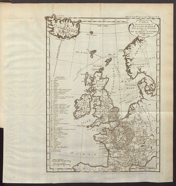
First mineralogical map, covering all of Europe, by Jean-Étienne Guettard, in Memoires de l’académie royale des sciences pour 1746 (Linda Hall Library)
Guettard read and published a paper in the Memoires in 1752 in which he argued that the basalt of the Auvergne region was volcanic in origin and had cooled from a molten state, which was new to just about everyone. Credit for this observation is usually given to Nicolas Desmarest, who read a paper making the same claim in 1771, printed in 1774; in fact, I gave such credit in my post on Desmarest. But I do not take it back, because Guettard later made an about-face and argued that basalt has an aqueous origin. And Desmarest's exposition, complete with a map, tracing lava flows and basalt formations back to craters, was much more thorough and convincing.
Guettard spent much of his later life working on a mineralogical atlas of France,which was to have contained well over 200 maps; his colleague in compiling the atlas was the young Antoine Lavoisier, who would later acquire much more fame as a chemist. The Atlas et description minéralogiques de la France was published in 1780 in a very incomplete form, with only 31 maps, and the publishing process was messy, as a third party was brought in, essentially replacing Guettard. But at least Guettard got his name on the title page, which is more than Lavoisier managed to do. We do not have the Atlas in our collections. You can see the title page, and read more about the publication of the Atlas, in the excellent post on the History of Information website.
There seems to be only one authentic portrait of Guettard, which appears on most webpages that discuss Guettard (second image). I do not know where it resides, or when it was painted. It would be nice to know more about it.
William B. Ashworth, Jr., Consultant for the History of Science, Linda Hall Library and Associate Professor emeritus, Department of History, University of Missouri-Kansas City. Comments or corrections are welcome; please direct to ashworthw@umkc.edu.