Scientist of the Day - Joseph-Paul Gaimard
Joseph-Paul Gaimard, a French zoologist, was born Jan. 31, 1796. Charles Darwin went on a single scientific voyage, which provided him with enough material for a one-volume narrative, a 5-volume zoology, 3 volumes on geology, and, ultimately, The Origin of Species. Gaimard was a naturalist on four major scientific voyages, and he was involved in the publication of four sets of narratives. No wonder he had no time to foment a revolution in scientific thought.

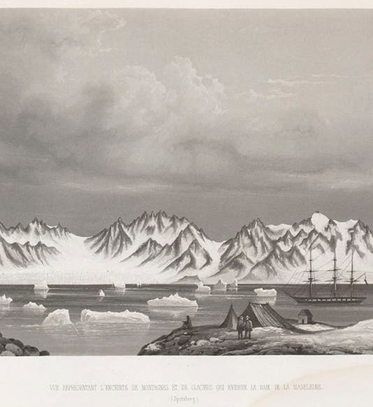
View of glaciers at Bell Sound, Spitzbergen, aquatint, from Joseph-Paul Gaimard, Voyages … en Scandinavie, en Laponie, au Spitzberg et aux Feröe, 1840-55 Atlas geologique (Linda Hall Library)
Gaimard's first voyage was a circumnavigation of the globe on the Uranie, 1817-20, led by Louis Claude Desaulses de Freycinet, where he was assistant surgeon and an unofficial naturalist, serving with surgeon Jean Rene Constant Quoy. The second voyage was the search for La Perousse on the Astrolabe, 1826-29, where he was now principal surgeon; Quoy accompanied him on this voyage as well, now with “naturaliste” as his official title. Both of these voyages resulted in sumptuous narratives, which we have displayed on several occasions, in our Voyages exhibition of 2002 (here and here), and The Grandeur of Life, 2009 (here and here). We featured Quoy (with frequent reference to Gaimard) as our Scientist of the Day several years ago.

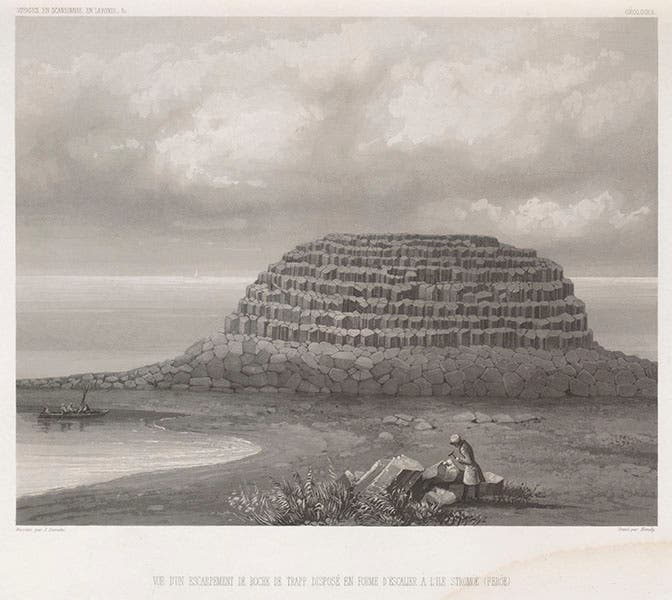
Columnar basalt in the Feroe Islands, aquatint, from Joseph-Paul Gaimard, Voyages … en Scandinavie, en Laponie, au Spitzberg et aux Feröe, 1840-55 Atlas geologique (Linda Hall Library)
That would have been enough for most naturalists. But in 1835-6, Gaimard was on board the Recherche as the scientific leader of an expedition to Iceland and Greenland. And finally, in 1838-40, he was again the scientific leader on the Recherche, this time on an expedition to northern Norway, Lapland, Spitzbergen, and the Faroe Islands. Gaimard spent nearly all his remaining years editing the narratives of these two expeditions; the Voyage en Islande et au Groėnland was published in 9 volumes from 1838 to 1852, and the Voyages de la Commission scientifique du Nord en Scandinavie, en Laponie, au Spitzberg et aux Feröe was published in 26 text volumes and 5 plate volumes between 1842 and 1855. No wonder Gaimard completely disappeared from public life after his return in 1840.

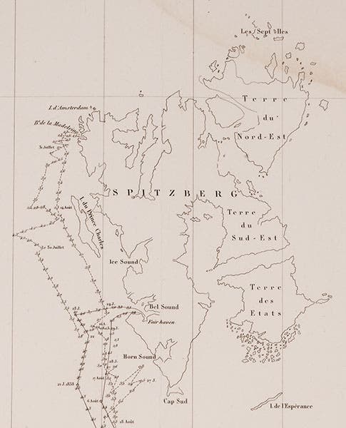
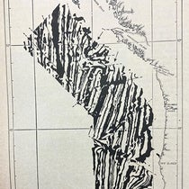
Detail of map of the voyage of Recherche, 1838-40, showing Spitzbergen, engraving from Joseph-Paul Gaimard, Voyages … en Scandinavie, en Laponie, au Spitzberg et aux Feröe, 1840-55 Atlas geologique (Linda Hall Library)
Today we are featuring the illustrations in the geological atlas volume of the voyage to Spitzbergen, which is actually 3 volumes in one. Our opening image is a view of the glaciers and mountains at Madeleine Bay, Spitzbergen. We have included a detail from a map of the voyage that appears in the same volume (fourth image); you can see the location of Madeleine Bay there, on the northwest coast.

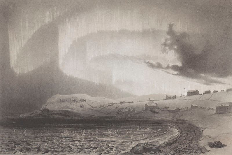
Aurora observed at Bossekop, Finnmark, Jan. 21, 1839, tinted lithograph from Joseph-Paul Gaimard, Voyages … en Scandinavie, en Laponie, au Spitzberg et aux Feröe, 1840-55 Atlas geologique (Linda Hall Library)
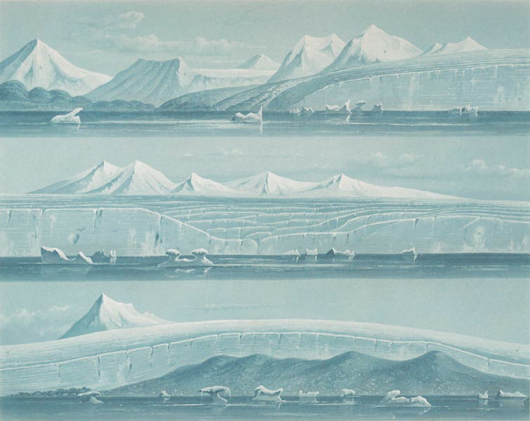
Another engraving shows the glaciers at Bell Sound, a little further south on Spitzbergen (second image). This engraving was printed with a blue-green ink, as you have no doubt noticed. Not quite so obvious is the fact that this is an aquatint, like the first image, which is why both look so much like watercolors. One does not often find aquatints in voyage narratives – this volume has many.
The next illustration is also an aquatint, but it shows a feature more obviously geological – columnar basalt on the Faroe Islands (third image). We were not aware of this plate when we compiled the section on northern basalt in our Vulcan’s Forge exhibition or we might have included it there.
The engraved map (fourth image) shows surface sea temperatures for the entire voyage of the Recherche, and can function as route map, but it is impossible to read if we display the entire plate. So we show the top center section, containing Spitzbergen, where the expedition seems to have spent much of its time.

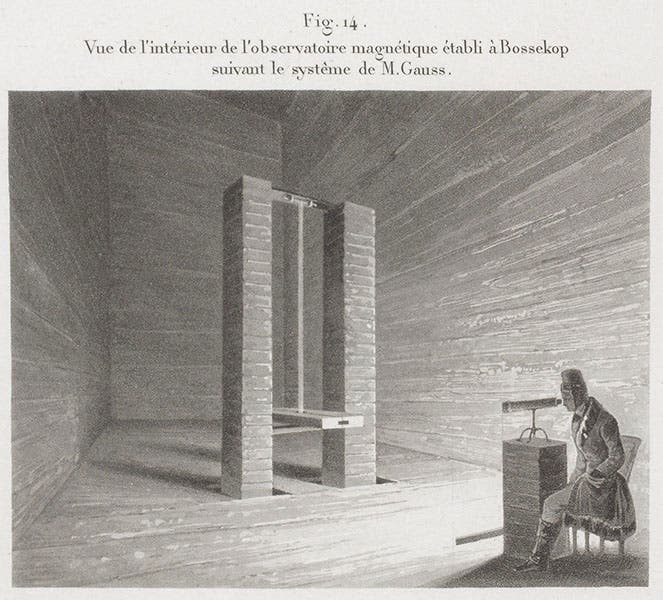
The interior of the magnetic observatory built at Bossekop, Finnmark, detail of larger engraving showing details of a magnetometer, from Joseph-Paul Gaimard, Voyages … en Scandinavie, en Laponie, au Spitzberg et aux Feröe, 1840-55, Atlas geologique (Linda Hall Library)
Gaimard must have been fascinated by auroras, for he includes 15 views of the northern lights, 10 of them full page. These are lithographs, not aquatints, and they are untinted, but they are graphically striking. The one we show is probably the most dramatic, an aurora observed at Bossekop, Finnmark (northern Norway), on Jan 21, 1839 (fifth image). Our last illustration from the Atlas, is a detail from a larger plate, shows the interior of a magnetic observatory, also at Bossekop, that had been set up to study and record the earth’s magnetic field (sixth image). It reminds us that this was a scientific voyage, not a sight-seeing expedition, and there is a great deal of data in both the text and atlas volumes of the narrative.

Portrait of Joseph-Paul Gaimard, engraving, from his Voyage en Islande et au Groėnland, 1838-52 (University of Wisconsin Libraries)
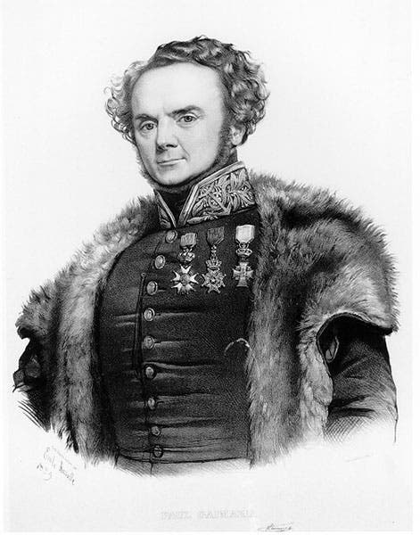
Gaimard was by all accounts a gregarious and affable man (and perhaps a little bit full of himself), and much beloved by the island peoples he visited. When he traipsed around Iceland, he passed out engravings of himself to villagers and they proudly affixed them to their walls, as later visitors attested. One of those portraits was included in the Voyage to Iceland, which we do not own, so we borrow the image from the copy at the University of Wisconsin – Madison (last image).
Dr. William B. Ashworth, Jr., Consultant for the History of Science, Linda Hall Library and Associate Professor emeritus, Department of History, University of Missouri-Kansas City. Comments or corrections are welcome; please direct to ashworthw@umkc.edu.