Scientist of the Day - Matthew Fontaine Maury

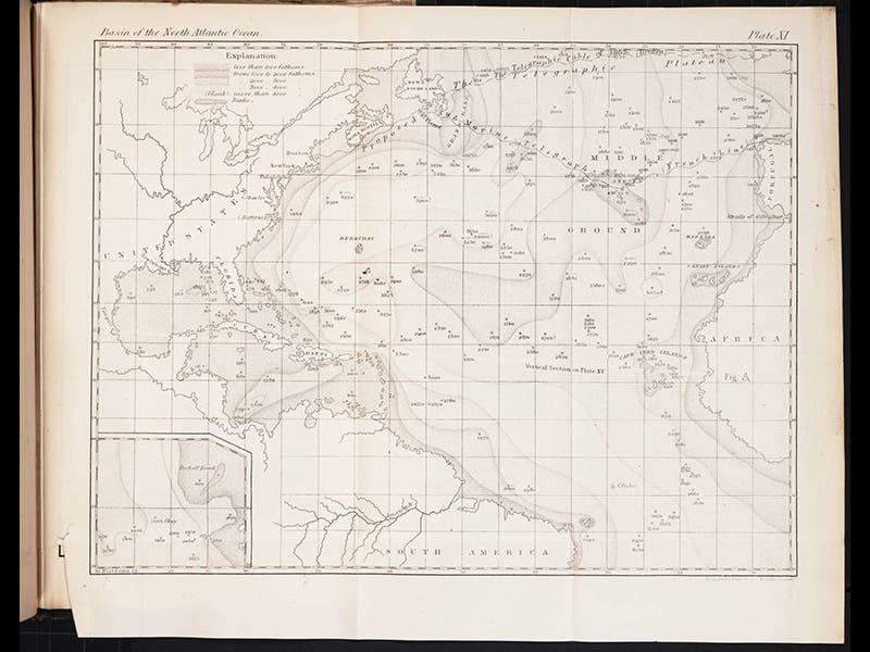
Matthew Fontaine Maury, an American oceanographer, was born Jan. 14, 1806. Maury was in fact the first American oceanographer, making it his business, as Director of the Depot of Charts and Instruments for the U.S. government, to sponsor surveys and expeditions to gather information on the temperature, currents, and salinity of the open sea, and the contours of the sea bottom. His timing was very good, because in 1854, American entrepreneur Cyrus Field got the idea of trying to extend a submarine telegraph cable from Ireland to Newfoundland, and he had no idea whether such a thing was geographically feasible. Most writers on the undersea world thought that the ocean was immensely deep and covered with peaks and canyons, like an underwater Alps, which would have made laying a cable across it technically impossible. So Field asked Maury, who had just sent a survey vessel across the upper Atlantic, and Maury told Field that there was a relatively shallow plain that ran across the North Atlantic to Ireland, and Maury even named it, for the occasion, the "Telegraphic Plateau.” An English expedition confirmed the existence of the plateau, lying at a maximum depth of about 2000 fathoms (2 1/2 miles), and so Field decided it was worth the gamble. The first completed cable of 1858, laid out on the plateau, operated for only a month, before it failed due to cable design problems, but the cables of 1865 and 1866, also resting on Maury's plateau, were a complete success.
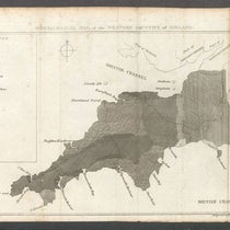
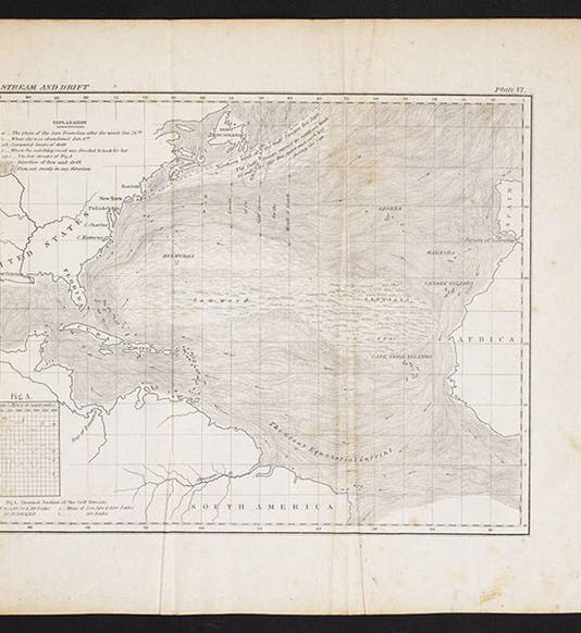
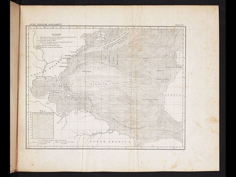
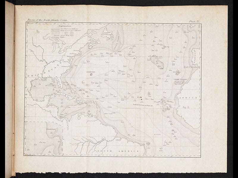
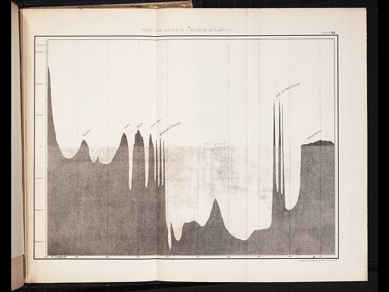
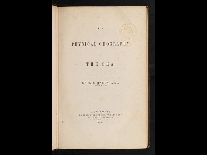
Maury's pioneer text, The Physical Geography of the Sea, first appeared in 1855 (see fifth image above), and that edition has nice maps of the Gulf Stream (first image above), and the North Atlantic Basin (second image above), but they do not yet show the Telegraphic Plateau. The 1860 edition has the same set of maps, but now modified to reflect the location of the plateau and the failed cable of 1858 (third image above; the plateau is at the very top). There is also a vertical section of the North Atlantic (fourth image above), which shows why the discovery of the plateau was important for cable planners like Cyrus Field.
Dr. William B. Ashworth, Jr., Consultant for the History of Science, Linda Hall Library and Associate Professor, Department of History, University of Missouri-Kansas City