
Scientist of the Day - John Snow

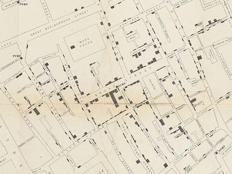
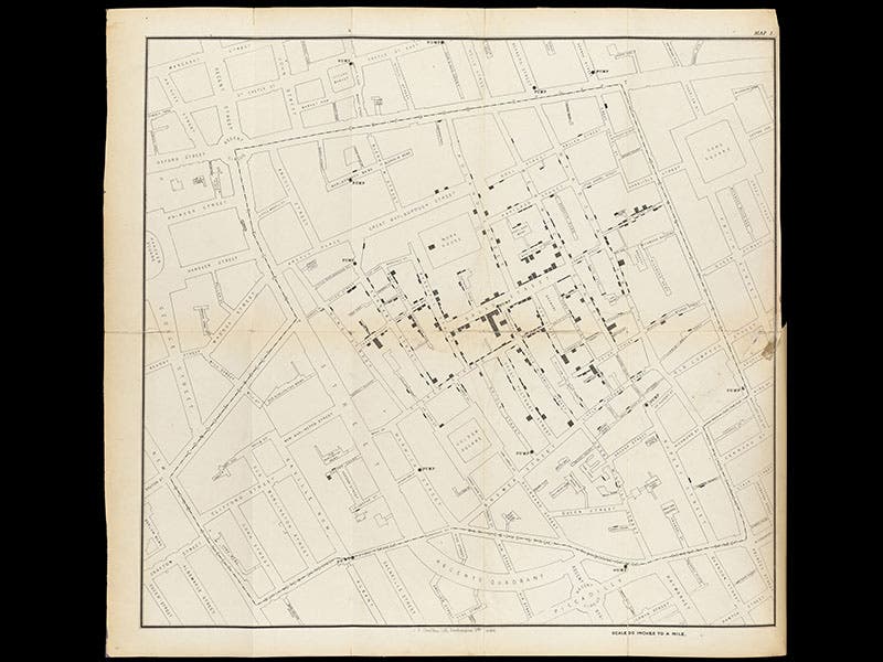

John Snow, an English physician, was born Mar. 15, 1813. In 1854, London was suffering through yet another cholera epidemic. Snow had long suspected that cholera is not caused by “miasmas” (air-borne infections), but rather by contaminants in the water supply. During this epidemic, which began on Aug. 31 and produced hundreds of fatalities, Snow started plotting incidents on a map, with each dot (actually, a small rectangle) representing a death from cholera (second image). This new kind of statistical map, now called a spot map, showed that the cholera cases were concentrated around a public water pump on Broad Street. If the water in the pump were contaminated by fecal material, that would explain the clustering of fatalities near the pump.
But what about the anomalies? Workers at a nearby brewery and a workhouse suffered no cases of cholera. Snow discovered that they had their own water source. There were other deaths far removed from Broad Street, and Snow found that the victims had brought in water from the Broad Street Pump. Snow presented his evidence and conclusions to the Board of Guardians of the local parish on Sept. 7, and the next day, the pump was shut down (according to a popular story, they simply removed the handle from the pump). But in spite of Snow’s brilliant piece of statistical analysis and argument, very few medical men were convinced that cholera was water-borne, and when he died four years later, his theory of water-born contagion had very few followers. He is now, of course, widely recognized as a pioneer in epidemiology and the study of infectious disease.
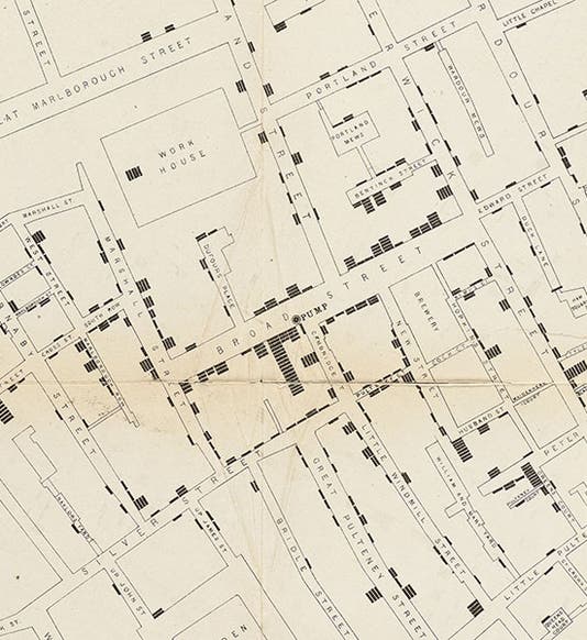
A detail of the center of the map (first image) shows the pump and the nearby dwellings. Note that one unfortunate house is marked with 18 rectangles of death. The portrait, a photograph (third image), is the only one that survives. The images of the printed map (1855) are from the copy at the Wellcome Library, London.
Dr. William B. Ashworth, Jr., Consultant for the History of Science, Linda Hall Library and Associate Professor, Department of History, University of Missouri-Kansas City. Comments or corrections are welcome; please direct to ashworthw@umkc.edu.


