Scientist of the Day - Joseph Nicollet
Joseph Nicolas Nicollet, a French astronomer and cartographer, was born July 24, 1786. When he lost his fortune in the July Revolution of 1830, Nicollet came to the United States, offering his services to the government in the mapping of the West. After making an expedition on his own to the upper Mississippi River in 1836, he was commissioned by the new Corps of Topographical Engineers, founded in 1838, to lead an expedition to the headwaters of the Mississippi. His assistant on this venture of 1838, and on a follow-up expedition on the Missouri River the next year, was John Fremont, soon to become famous in his own right as a Western explorer. Nicollet collected accurate readings of longitude, latitude, and altitude wherever he went, some 90,000 measurements in all. Latitude was determined using a barometer, which was a novelty in American cartography at the time. Upon his return, he helped compile a mammoth map of the Midwest, the first accurate map of this part of the country. Sadly, Nicollet suffered from intestinal cancer and died in 1843, just before a slightly reduced version of his map was published.

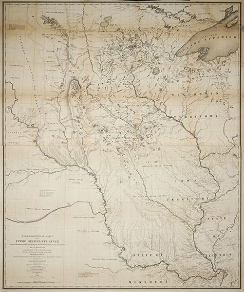
Hydrographical Basin of the Upper Mississippi River, map by J. N. Nicollet, 1843 (Linda Hall Library)
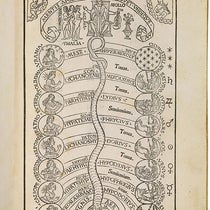
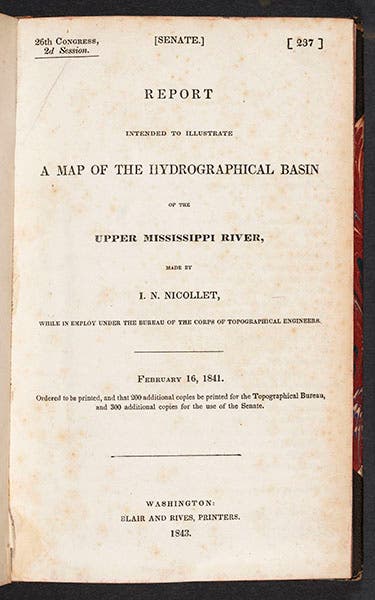
Nicollet’s map appeared in a publication called Report Intended to Illustrate a Map of the Hydrographical Basin of the Upper Mississippi River (1843), which we have in our collections (fourth image). The map has its own title: Hydrographical Basin of the Upper Mississippi River, From Astronomical and Barometrical Observations Surveys and Information by J. N. Nicollet in the years 1836, 37, 38, 39, and 40, assisted in 1838, 39 and 40 by Lieut. J.C. Fremont of the Corps of Topographical Engineers. Even though it is reduced from Nicollet’s original map, the printed map is still quite large, 40” x 33”. Originally the map was folded multiple times so that it could be included with the report; our copy of the map has been removed, flattened, and is stored in a large flat case, which is a situation much kinder to the map. We see here the entire map (second image); a detail of the legend, giving credit to Nicollet for the measurements and the original map (third image); a detail of the region of the upper Mississippi River (first image); and a detail of the Kansas City area, where the Missouri River makes its big bend from southerly to easterly flow (fifth image).

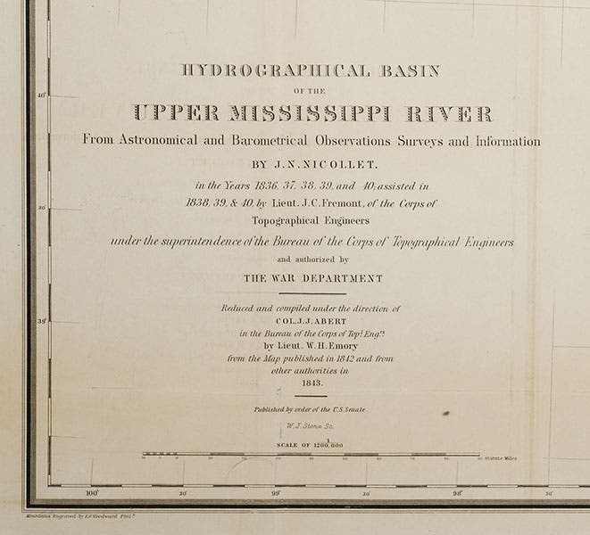
The legend of J.N. Nicollet’s map of the Upper Mississippi River, detail, 1843 (Linda Hall Library)
In the detail of the upper Mississippi (first image), you will see that Nicollet traced the source of the Mississippi River to Lake Itasca in north central Minnesota. This was not an original discovery – Henry Schoolcraft had discovered the lake 6 years earlier – but it was correct, making this the first map to track the Mississippi from its source to St. Louis.

Title page of J. N. Nicollet, Report Intended to Illustrate a Map … of the Upper Mississippi River, 1843
Fifteen years ago, we mounted an exhibition here at the Library called Science Goes West – one of our favorite exhibitions, but one that has no print or electronic legacy, much the pity. We very much wanted to display Nicollet's map as part of the exhibit, but it would not fit in any of our displasy cases, so we had to exhibit the Report, which was a poor substitute (fourth image). When we opened our new exhibit halls in 2006 with an exhibition of the Description de l'Egypte, we found it necessary to acquire several over-size exhibition cases in order to display some of the largest volumes from Napoleon's expedition. So now, perhaps, we could display the Nicollet map, should we ever find another suitable occasion.

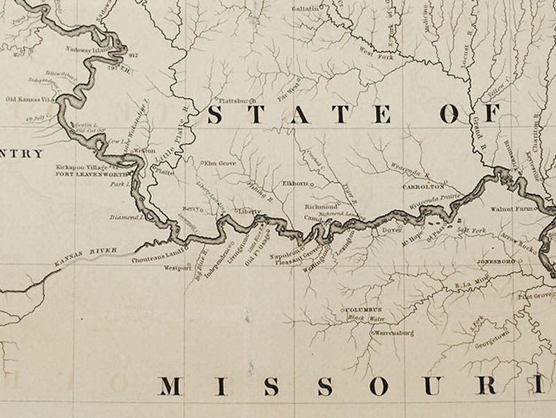
The Kansas City area, where the Missouri River turns east, on J. N. Nicollet’s map of the Upper Mississippi River, detail, 1843 (Linda Hall Library)
Finally, we call the attention of our local audience to the detail of Kansas City (fifth image). You will readily find Westport and Independence marked on the map, but not Kansas City. Our future metropolis is indicated only by the label "Chouteau's Landing".
Tombstone of J. N. Nicollet, Congressional Cemetery, Washington, D.C. (findagrave.com)
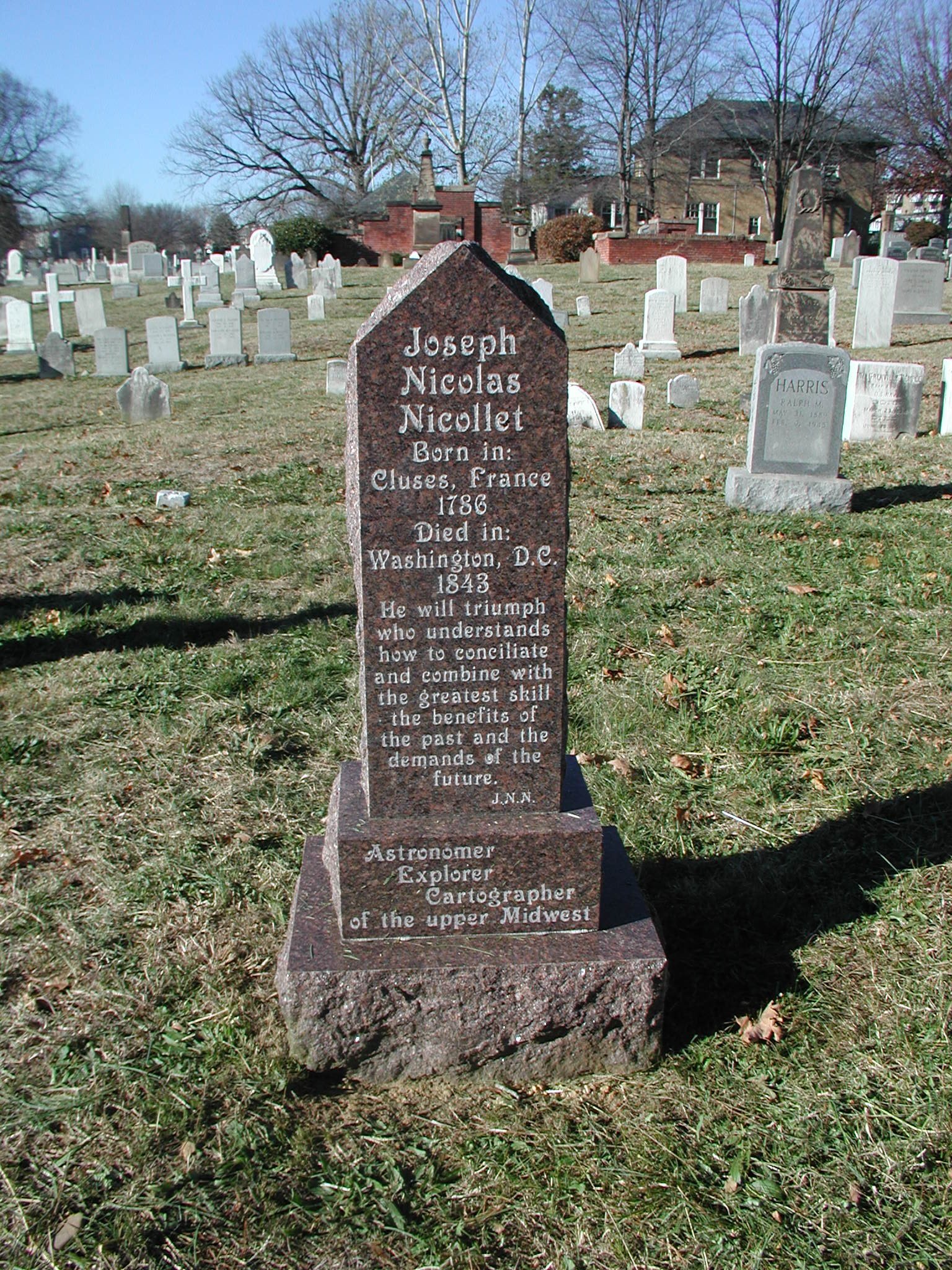
Nicollet was buried in the Congressional Cemetery in Washington, D.C., marked by a handsome memorial stone, on which he is identified, fittingly, as Astronomer, Explorer, Cartographer of the Upper Midwest (sixth image). Dr. William B. Ashworth, Jr., Consultant for the History of Science, Linda Hall Library and Associate Professor, Department of History, University of Missouri-Kansas City. Comments or corrections are welcome; please direct to ashworthw@umkc.edu.