Scientist of the Day - Nicolas Desmarest
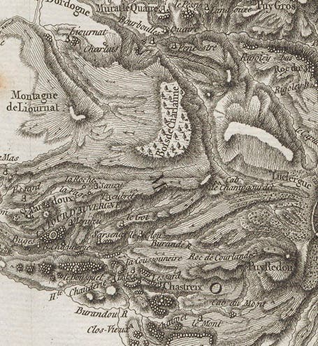
Nicolas Desmarest, a French geologist and cartographer, was born Sep. 16, 1725. When Desmarest began his career, it was thought that basalt formations, such as the Giant’s Causeway in Ireland, were sedimentary deposits. In 1763, Desmarest began mapping the Auvergne region of central France, which contains most of that country’s mountains. He noticed that the mountains were not at all like the Alps, but had the shapes and features of volcanoes, even though no active eruptions had ever been recorded there. And he found basalt formations everywhere, the source of which he was able to trace to the volcano-like craters.

Geological map of Auvergne region of France, by Nicolas Desmarest, Memoires de l’académie royale des sciences pour 1771 (Linda Hall Library)
In 1771, Desmarest presented a geological map of the Auvergne region to the Paris Academy of Sciences, locating all the craters and basalt formations (second image), and in the accompanying memoir (third image), he argued that the mountains of the region were once volcanic, and that basalt in the area came from those volcanic mountains. Thus basalt is a volcanic, or igneous, rock, and not sedimentary at all. Desmarest was really the first to suggest that volcanoes had been important forces in shaping the face of the earth in the deep past, and that wherever we see basalt, we are observing the remains of past volcanic action.

First page of Nicolas Desmarest’s paper “Sur l’origine & nature du Basalte, Memoires de l’académie royale des sciences pour 1771 (Linda Hall Library)
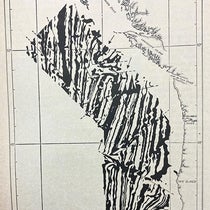
Interestingly, the sixth plate volume of the great French Encyclopédie had been published in 1768, and one of the plates in the “Mineralogie section” depicted the basalt formation known as the “Tour d’Auvergne" (fourth image). It turns out that the captions for this and one other plate in this Encyclopédie plate volume were written by Desmarest, after he had surveyed the Auvergne region but before he wrote his milestone paper. Not surprisingly, the captions suggest that these basalt formations are volcanic in origin. You can see the location of the Tour d'Auvergne in a detail of Desmarest’s map (first image).

View of columnar basalt at the Tour d’Auvergne, from Encyclopédie, plate volume 6, 1768 (Linda Hall Library)
In another detail, we see the legend for the map (fifth image). It indicates that Desmarest fully understood that one can distinguish ancient lava flows from more recent ones, and that the “prismes de basalt” (columnar basalts) were clearly related to the lava flows.

Detail of map legend, showing the symbols for ancient currents, masses of lava, modern currents, prismatic (columnar) basalt, and basalt “boules,” Memoires de l’académie royale des sciences pour 1771 (Linda Hall Library)
We displayed Desmarest's geological map in our 2004 exhibition, Vulcan's Forge and Fingal's Cave. An earlier Scientist-of-the-day post on Leopold von Buch contains, as its second image, a splendid aquatint view of the volcanic “puys” of the Auvergne.

Portrait of Nicolas Desmarest, engraving by Ambroise Tarieu, no date (Wellcome Collection)
Dr. William B. Ashworth, Jr., Consultant for the History of Science, Linda Hall Library and Associate Professor, Department of History, University of Missouri-Kansas City. Comments or corrections are welcome; please direct to ashworthw@umkc.edu.