Scientist of the Day - Wilhelm Gotthelf Lohrmann

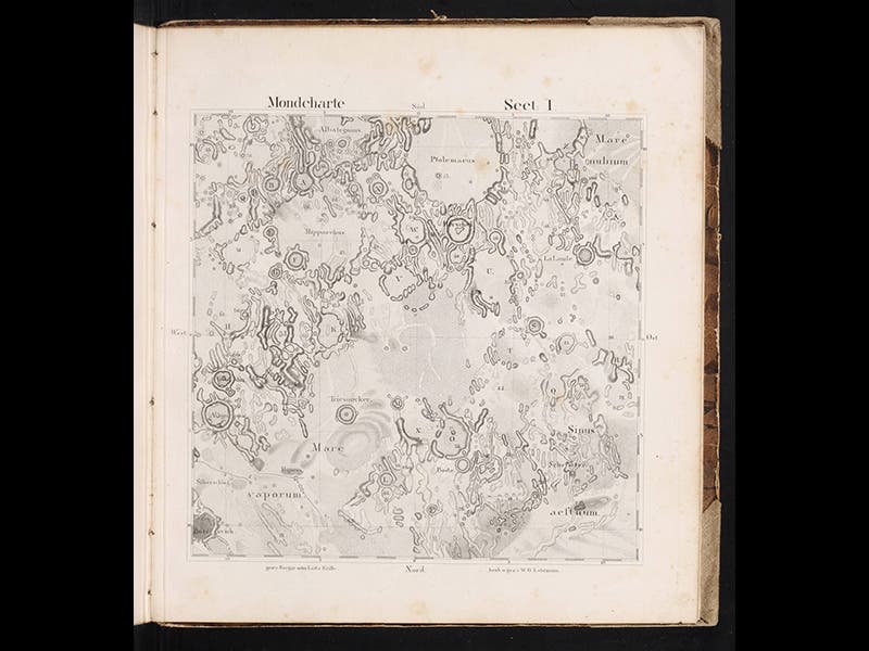
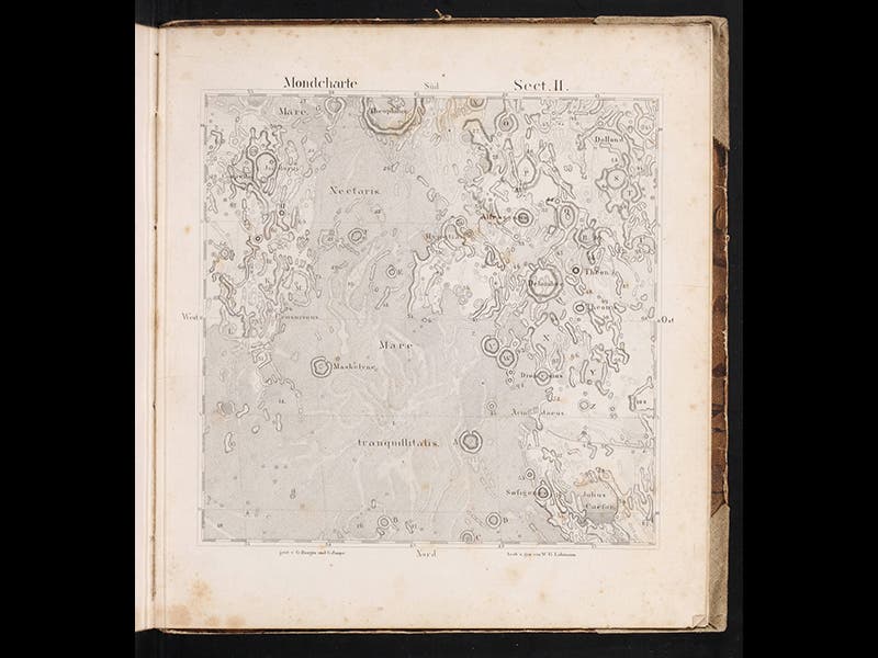
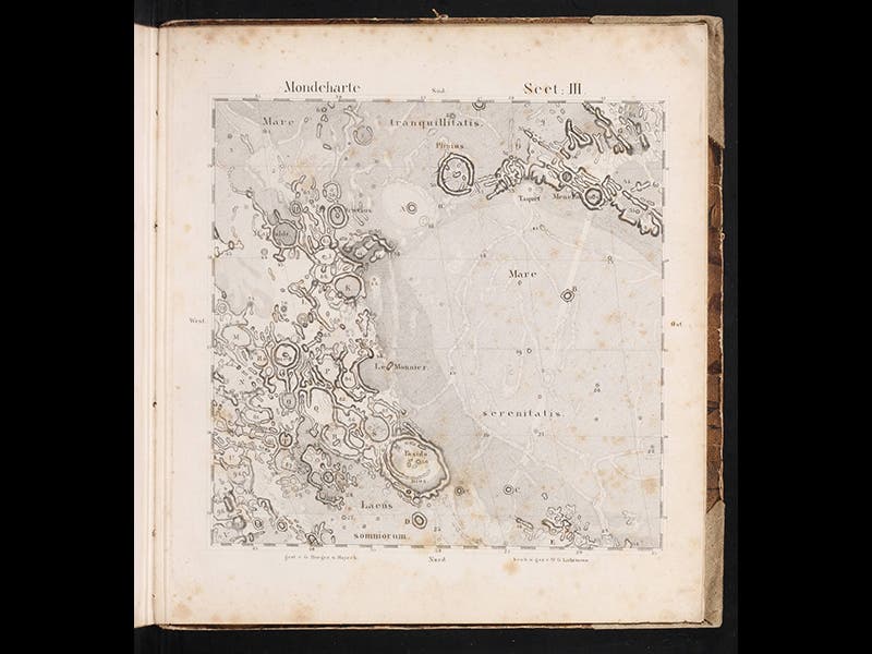
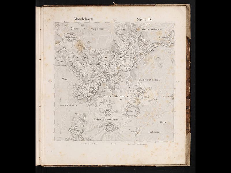
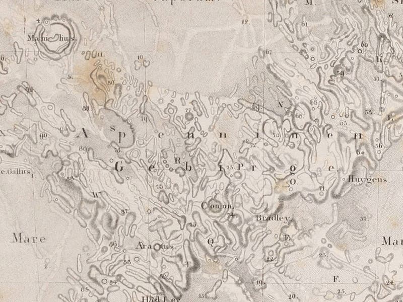
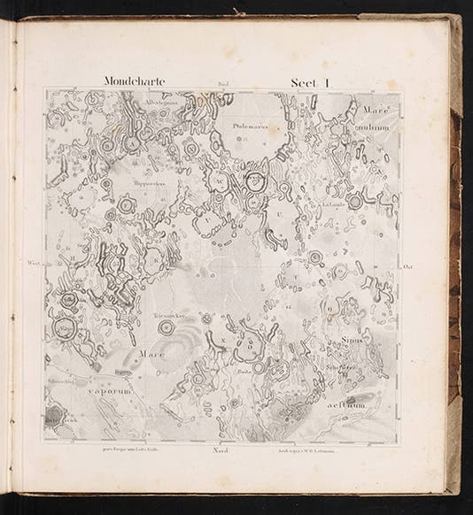
Wilhelm Lohrmann, a German cartographer, died Feb. 20, 1840, at age 44. In 1824, Lohrmann published his Topographie der sichtbaren Mondoberflaeche (Topography of the Visible Lunar Surface) in which he described his technique of using a micrometer to determine the exact position of certain fixed points on the surface of the moon, which he used as reference points to determine the precise positions of all the craters, rilles, and seas. He contemplated an entire lunar map based on his observations, but in 1824, he had completed only four of a projected 25 sections, so that is all he published. You can see all four above; in the order he included them. They show: an area in the lunar highlands that includes the craters Ptolemy and Hipparchus; the Sea of Tranquility, where Apollo 11 would later land; the Sea of Serenity, just below the Sea of Tranquility, and the Lunar Apennines, including the crater Archimedes, where Apollo 15 would land in 1971. The last image is a detail of the fourth plate, allowing us to appreciate the detailed precision that went into drawing and engraving each section.
Lohrmann did later finish the remaining 21 sections, but he didn’t live long enough to publish them. However, in 1878, Julius Schmidt, himself a great lunar cartographer, published Lohrmann’s complete lunar atlas, which was popular enough to warrant reissuing in 1892. We displayed Lohrmann’s 1824 Topographie, with 4 maps, and the 1892 reissue, with 25 maps, in our 1989 exhibition, The Face of the Moon: Galileo to Apollo; here is the 1824 entry, and the one for 1892. We have since acquired the first Schmidt edition of Lohrmann (1878), giving us a complete set of all the various Lohrmann lunar maps.
Dr. William B. Ashworth, Jr., Consultant for the History of Science, Linda Hall Library and Associate Professor, Department of History, University of Missouri-Kansas City