Scientist of the Day - John Gunnison
John Williams Gunnison, a captain in the Corps of Topographical Engineers of the U.S. Army, was born Nov. 11, 1812. On several occasions we have discussed the expeditions sent west by the U.S. Congress in 1853 to survey possible routes for a transcontinental railway, most recently with our post on Andrew A. Humphreys just nine days ago. Gunnison led one of those survey parties, heading west along the 38th and 39th parallels through southern Colorado. He had earned his bars by assisting on the Stansbury expedition to Utah and the Great Salt Lake in 1849, which you can read about in our post on the leader, Howard Stansbury.

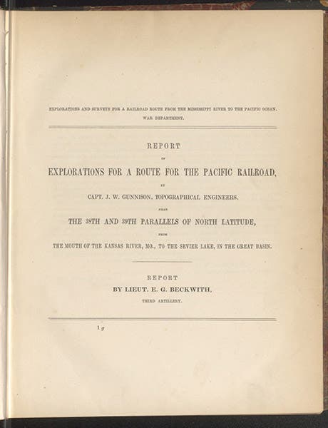
Title page, Report of Explorations for a Route for the Pacific Railroad by Capt. J.W. Gunnison, by Edward Beckwith, vol. 2 of the Pacific Railroad Reports, 1855 (Linda Hall Library)
A railroad route along the 38th parallel was one being advocated by Senator Thomas Hart Benton of Missouri, great uncle to the painter. Gunnison took his crew west through southern Colorado, exploring the canyons of what was then called the Grand River. His assistant was Edward Beckwith, and his artist the gifted Richard Kern, who had already drawn and published a memorable view of the White House cliff dwelling in Canyon de Chelly in Arizona (first image at our post on James Hervey Simpson). The survey party made it all the way through Colorado and into Utah, where Gunnison and a party of 11 men were attacked by Utes, on Oct 26, 1853. Gunnison, Kern, and 6 others died in the massacre. Gunnison’s expedition was the only one of the 7 railroad survey expeditions that suffered such a tragedy. Gunnison was just shy of his 42nd birthday.

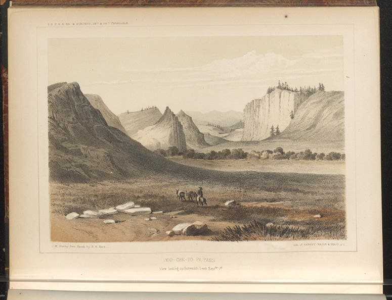
Co-chee-to-pa Pass, tinted lithograph by John Mix Stanley after a sketch by Richard Kern, in Report of Explorations … by Capt. J.W. Gunnison, by Edward Beckwith, 1855 (Linda Hall Library)
The 38th-39th-parallel expedition was completed by Lt. Beckwith, who picked up another artist, Frederick W. von Egloffstein, in Salt Lake City, to replace Kern. Beckwith's narrative was published as the second volume of the 13-volume Pacific Railroad Reports in 1855. The sketches by Kern were turned into tinted lithographs by noted American Indian artist John Mix Stanley, who had just returned from the railroad survey that went west through the Dakotas and Montana. Stanley also produced lithographs of some of the sketches by Egloffstein, who also did all of the topographic maps of the area. We show here three of the lithographs, one in its entirety, two in detail. Egloffstein’s drawing of the Black Canyon is probably the most dramatic of all the lithographs in the Beckwith/Gunnison volume (fifth image, below).

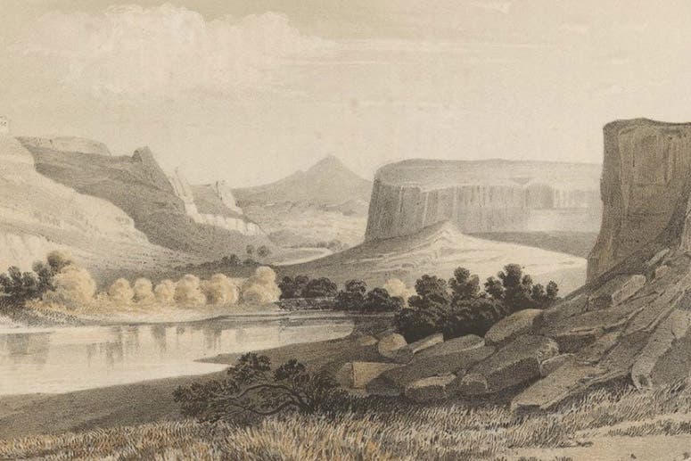
Head of the first canyon of Grand River, detail of a tinted lithograph by John Mix Stanley after a sketch by Richard Kern, in Report of Explorations … by Capt. J.W. Gunnison, by Edward Beckwith,1855 (Linda Hall Library)

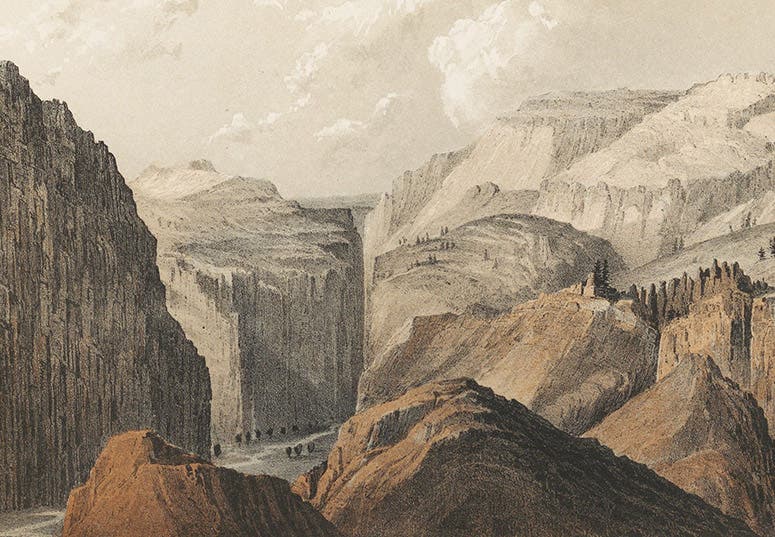
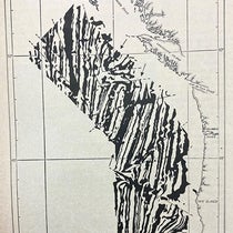
Black Canyon of the Grand River, detail of a tinted lithograph by John Mix Stanley after a sketch by Frederick W. von Egloffstein, in Report of Explorations … by Capt. J.W. Gunnison, by Edward Beckwith, 1855 (Linda Hall Library)
After the Civil War, the Grand River was renamed the Gunnison River, and the Black Canyon of the Grand, drawn by Egloffstein, became the Black Canyon of the Gunnison. I explored the Black Canyon many years ago, in my younger days, and I can't think of a better way to be remembered than by being associated with a natural landmark as awe-inspiring as the Black Canyon. As a further bonus for Gunnison’s posterity, the area is now the Grand Canyon of the Gunnison National Park. We show a recent photograph below, in case you are already making vacation plans for next summer.

The Black Canyon of the Gunnison, modern photograph (Terry Foote on Wikimedia commons)
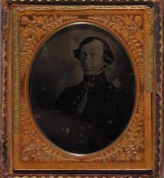
The portrait of Gunnison that we used as our opening image is an ambrotype, a variant of the daguerreotype that was popular in the early 1850s. It is the only known image of Gunnison, and it was recently sold at auction to the Colorado Historical Society, located in Denver.
Dr. William B. Ashworth, Jr., Consultant for the History of Science, Linda Hall Library and Associate Professor emeritus, Department of History, University of Missouri-Kansas City. Comments or corrections are welcome; please direct to ashworthw@umkc.edu.