Scientist of the Day - Joan Blaeu

Joan Blaeu, a Dutch cartographer, was born Sep. 23, 1596. Blaeu came from a long line of map-makers, and was the son of Willem Blaeu, another eminent cartographer. In 1662, Joan Blaeu published his Atlas maior, the Grand Atlas, in 11 thick folio volumes, which many consider the finest atlas ever published. With 594 double-page hand-colored engraved maps, it has an elegance and appeal that is truly jaw-dropping. Each volume treats a different set of countries (Scandinavia, the British Isles), or in several cases, an entire continent (Africa, America, Asia). We are very fortunate to have a complete set of the Atlas maior in the Library, bound in full vellum that is stamped with Blaeu’s printer’s mark.
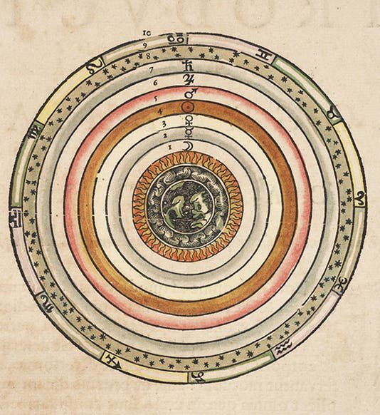
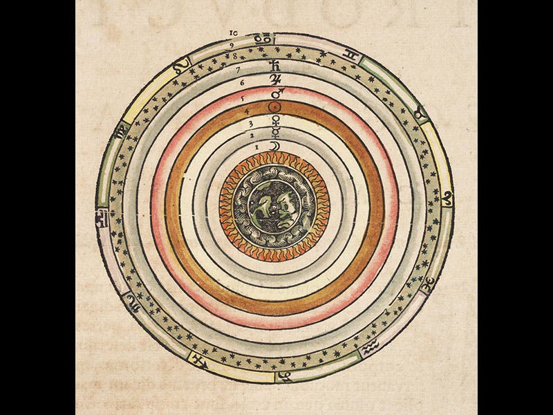
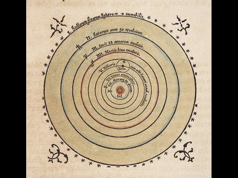
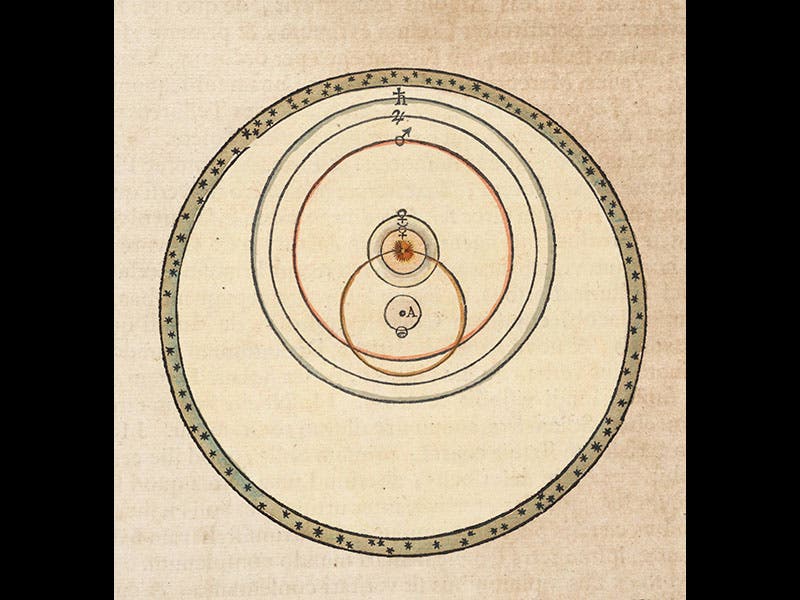
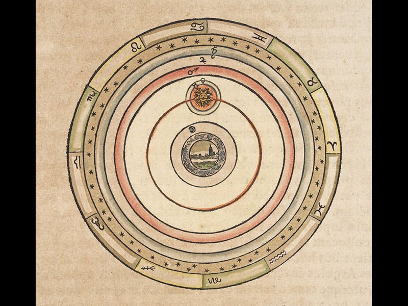
Since it is difficult to capture the beauty of large maps in this format, we thought we would today call attention to a feature of the Atlas maior that is often overlooked. The first volume, which treats Scandinavia, is well known for its images of Tycho Brahe's observatory on the Danish island of Veen, and we included two of those engravings when we made Tycho Brahe our Scientist of the Day last year (second and third images on Dec. 24, 2015). But few appreciate that in the introduction to this volume, Blaeu included text engravings of all the cosmological systems that were still in vogue in 1660 (geography and cosmology were often united at the time into a discipline known as cosmography, so it is not unusual to have cosmological diagrams in a work of geography). Thus we find illustrations of not only the Aristotelean geocentric system (first image), the sun-centered Copernican system (second image), and the geo-heliocentric Tychonic system (third image), but also lesser-known cosmologies such as the Egyptian or Capellan system, in which Mercury and Venus circle the sun while the remaining planets orbit a stationary earth (fourth image). Many books of this period, such as Giambattista Riccioli's New Almagest (1651), depict multiple cosmologies, but the hand-colored, elegantly drawn images of Blaeu are without peer, and they should be much better known, and much more frequently used to illustrate discussions of seventeenth-century cosmological debates.
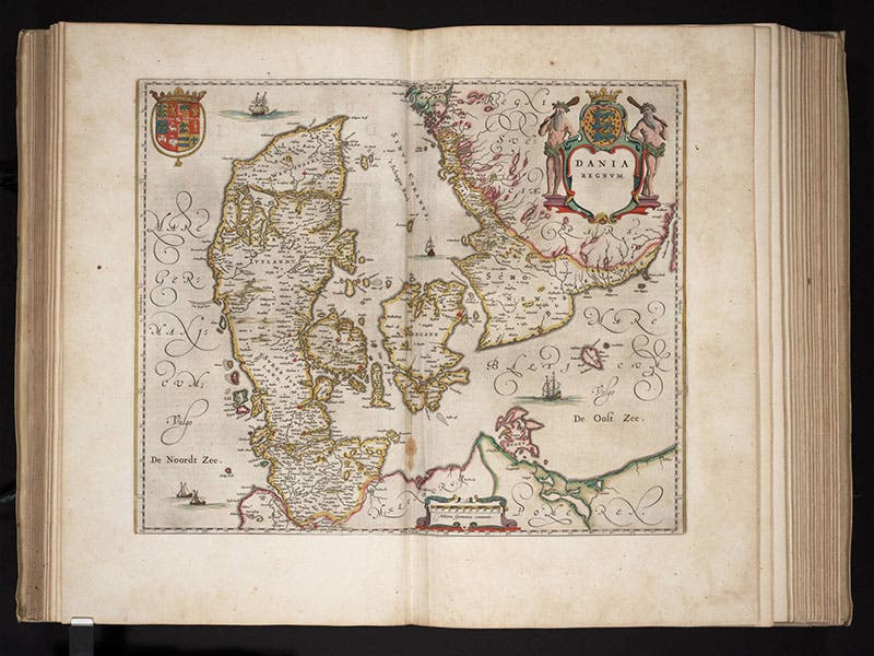
And if you must have a map, and we can see why you might insist, we append the double-page map of Denmark that also appears in volume 1 of the Atlas maior (fifth image).
Dr. William B. Ashworth, Jr., Consultant for the History of Science, Linda Hall Library and Associate Professor, Department of History, University of Missouri-Kansas City. Comments or corrections are welcome; please direct to ashworthw@umkc.edu.