Scientist of the Day - Johann Madler

Linda Hall Library
Linda Hall Library
Linda Hall Library
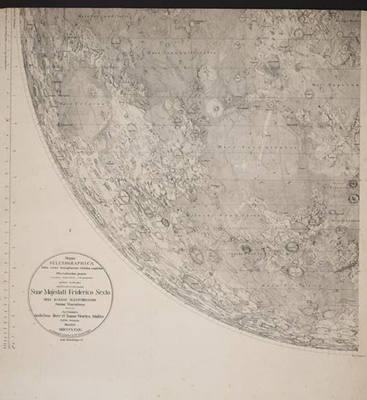
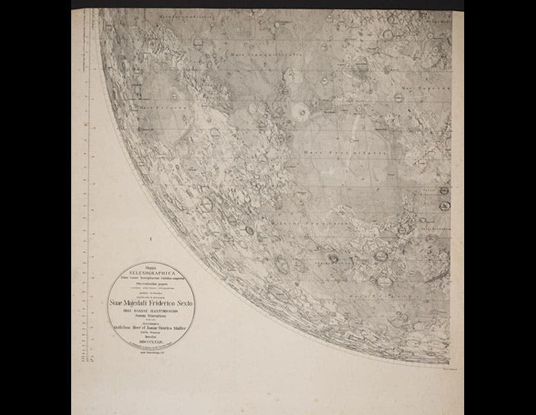
Johann Heinrich Mädler, a German astronomer, was born May 29, 1794. In 1834, financially supported by a banker friend, Wilhelm Beer, Mädler published the first large lunar map based on precise micrometric measurements, which simply means that he used a special device, in conjunction with a telescope, to measure distances and sizes on the moon. The Mappa Selenographica, as the Beer and Mädler map is titled, is over 38 inches across, which is quite large, compared to the famous lunar maps of Johannes Hevelius (1647) and Giambattista Riccioli (1651), on which the moon is barely 14 inches across. It took Mädler four years to make his measurements and plot them onto a map. Because of its size, the map was published in four sheets, which you can trim and put together if you like, or leave on separate sheets, or trim and leave separate, as in the copy in the Linda Hall Library. The map is also of interest because it was printed by lithography, a reasonably new technique at the time that had never before been applied to a lunar map.
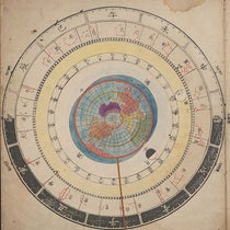
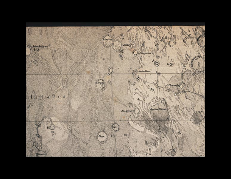
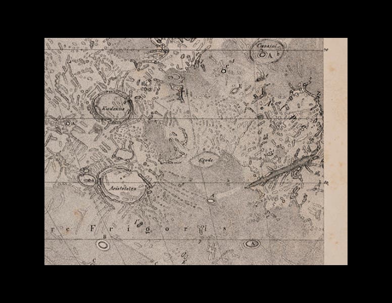
We acquired our copy of the Mappa Selenographica in 1978 during the auction of the famous Honeyman collection, and we displayed it in our exhibition of lunar maps, The Face of the Moon: Galileo to Apollo, in 1989. We show above the lower left quadrant of the map, which, because the map has south at the top, corresponds to the upper right or northeast quadrant of the moon as you see it in the sky (first image). You may be able to make out, near the top, the label “Mare Tranquilitatis,” the Sea of Tranquility, where Apollo 11 landed in 1969. We also include higher-resolution details of the Sea of Tranquility (second image), and the region around the Alpine valley and the craters Aristotle and Eudoxus, near the very bottom of the quadrant (third image). Compare the Alpine Valley detail to an earlier engraving of the same region, which we also displayed in the Face of the Moon exhibition.
The Mädler lunar map was the crown jewel of 19th century selenography, and it influenced every map that came after it for at least a century. The detail that it contains, visible only with a strong magnifier, is almost beyond belief.
Dr. William B. Ashworth, Jr., Consultant for the History of Science, Linda Hall Library and Associate Professor, Department of History, University of Missouri-Kansas City. Comments or corrections are welcome; please direct to ashworthw@umkc.edu.