
Scientist of the Day - Kenji Satake and Brian Atwater
On Jan. 26, 1700, there was a massive earthquake in the Pacific Northwest of North America, which rippled the landscape, devastated the forests of Washington, Oregon, and British Columbia, and probably killed thousands of Native Americans. The odd thing about the earthquake is that no one in modern times suspected its occurrence until 1996, when several Japanese seismologists, led by Kenji Satake, not only revealed the extent of the Cascadia earthquake, but dated it precisely to 9:00 PM on the evening of Jan. 26, 1700. The principal evidence was an "orphan tsunami" that had struck Japan on Jan. 27, 1700. Nearly every historical tsunami could be traced to an earthquake, but not this one – it had appeared out of the blue, quite literally, and caused a great deal of damage in Japan. Suspecting that it might have crossed the Pacific, Satake came upon the work of American geologist Brian Atwater and others, who had been investigating certain dead forests in the Pacific Northwest, where vast inland stands of cedars and spruces had apparently been drowned by sea water, creating “ghost forests.” Dendrochronologists were called in, and they determined that the last growth rings had been added in 1699, so that all the trees had died sometime between the fall of 1699 and the spring of 1700. Ethnologists contributed that Native American folk history of the Northwest told of giant oceanic floods that wiped out entire populations, such as the natives of Vancouver Island. The Japanese orphan tsunami of Jan. 27 allowed the final pinpointing of the date. The Cascadia earthquake was estimated to have been around magnitude 9.0, which makes it one of the Big Ones.
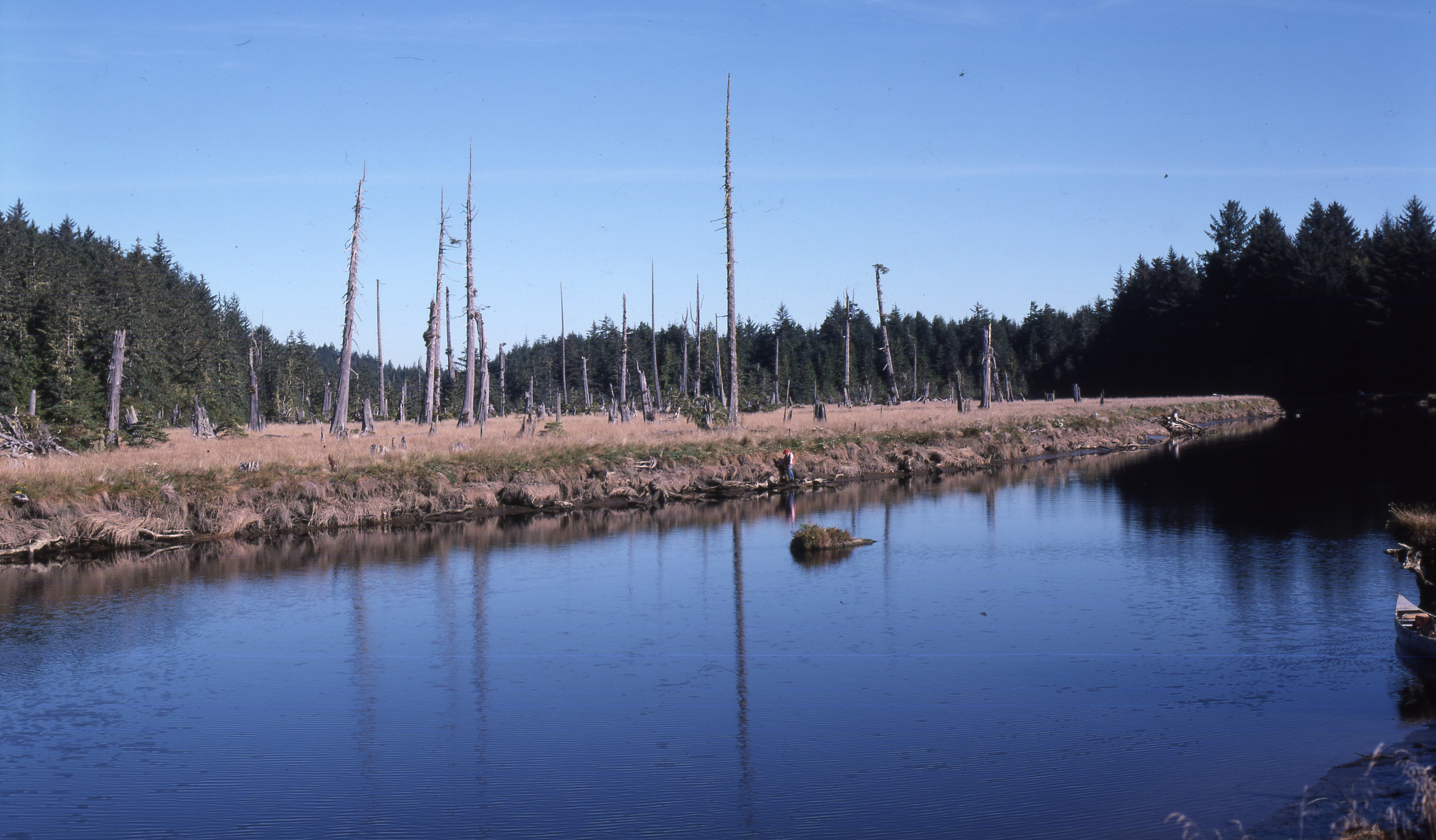
Ghost forest at Copalis Crossing, Oregon, a remnant of the 1700 Cascadia earthquake, photograph (graysharbortalk.com)
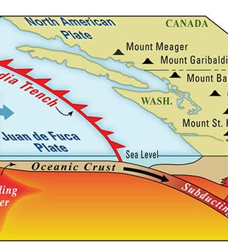
Seismologists had long known about the Cascadia subduction zone, where a tiny tectonic plate, the Juan de Fuca plate, pushes eastward under the much more massive North American plate (first image). Motion of this plate had caused the eruption of Mt. St. Helens in 1980, and indeed had raised most of the volcanic peaks of the Cascades. But no one knew about the massive 1700 earthquake until 1996, and the area has since been intensively studied. It now appears that large earthquakes along the Cascadia zone occur about every 240 years. And it has been 320 years since the last one. This has raised more than a little concern, since no area is less prepared for a large earthquake than the Pacific Northwest, which for a long time had no earthquake building codes at all.
The 1700 Cascadia earthquake could have been brought to public attention in 2005 by a large-format paperback book, The Orphan Tsunami of 1700: Japanese Clues to a Parent Earthquake in North America, compiled by Atwater, Satake, and several others (third image). It is a beautiful publication, with many color illustrations from old Japanese maps and sources, but it was issued as a U.S. Geological Survey Professional Paper – and was thence buried in the government documents section of most libraries, including ours, where I doubt that anyone had looked at before I pulled it off the shelf a while back.

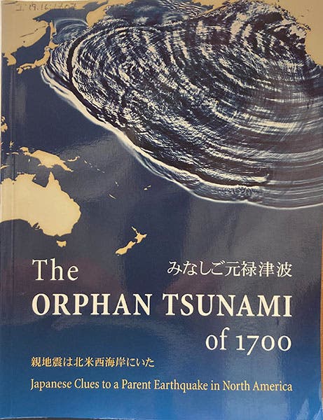
Front cover, The Orphan Tsunami, by Kenji Satake, Brian Atwater, et al., 2005 (Linda Hall Library)
The future Cascadia earthquake threat, and the lack of civic preparedness, was more successfully brought to public attention by an article titled “The Really Big One” in the New Yorker in 2015; this reached a vastly wider readership than the 2005 book, and caused some consternation among readers in the Northwest, since it predicted that the next Cascadia earthquake will be the worst natural disaster to ever strike North America and will lay complete waste to the area and the economy of Washington and Oregon. You may read the article here, but if you live in Seattle or Portland or Vancouver, make sure you are sitting down.
There is an effective animation of the 1700 Cascadia earthquake and the ensuing tsunami on YouTube, sponsored by the National Oceanic and Atmospheric Administration (NOAA), the National Weather Service, and the Pacific Tsunami Warning Center.
Finally, I should like to point out that while many web articles on the Cascadia 1700 earthquake are illustrated with a photo of the Neskowin Ghost Forest on the coast of Oregon, that forest of dead Sitka spruces was the result of an earthquake over 2000 years ago. It is the most magnificent of all the ghost forests, but it has nothing to do with the Big One of 1700.
Dr. William B. Ashworth, Jr., Consultant for the History of Science, Linda Hall Library and Associate Professor emeritus, Department of History, University of Missouri-Kansas City. Comments or corrections are welcome; please direct to ashworthw@umkc.edu.

![“Aurora Borealis,” hand-colored wood engraving by Josiah Wood Whymper, [Natural Phenomena], plate 2, 1846 (Linda Hall Library)](https://assets-us-01.kc-usercontent.com:443/9dd25524-761a-000d-d79f-86a5086d4774/0245ffcb-b70c-477c-8792-0a73ebd54eb2/Whymper%2011.jpg?w=210&h=210&auto=format&fit=crop)