Messier, Charles. "Carte celeste qui represente la route apparente de la comete de 1779...", in: Memoires Academie Royale des Sciences pour 1779. Paris, 1782.
Charles Messier was the foremost comet-hunter of his time. For every comet discovery, he published a map of the comet's trajectory in the Memoirs of the French Academy of Sciences. These maps, although not intended to be so, were also some of the most up-to-date star charts available.
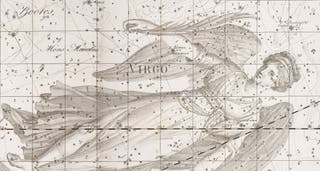
The image below is a detail of a much larger folding map of the comet of 1779; we can see the path of the comet as it went through Coma Berenices and Virgo. If we look at a further detail of the region around Coma, we see a number of nebulous objects with labels like "nebula 1777" or "nebula 1780." These are some of the nebulae that Messier was collecting and publishing almost simultaneously in his famous nebulae catalog of 1781. There are no less than 28 Messier objects depicted in the full comet map, many of them for the first time.
For his star charts, Messier used the plates in the Fortin edition of John Flamsteed, Atlas celeste, 1776.

